

The DJI Matrice 4D is an all-new water and dust-resistant industrial drone engineered for high-precision mapping, infrastructure inspections, and professional aerial operations. Designed to integrate seamlessly with the DJI Dock 3 or operate independently with the DJI RC Plus 2 Enterprise, the Matrice 4D redefines efficiency, reliability, and data capture quality for a wide range of industries.
Key Features:
-
Extended Flight Time & Robust Protection – Up to 47 minutes of flight time with an IP55 dust and water resistance rating, allowing reliable performance in harsh conditions.
-
Multi-Camera System – Equipped with wide-angle, medium tele, and tele cameras, along with a Laser Range Finder for unparalleled imaging capabilities.
-
Advanced Obstacle Avoidance – Features rotating LiDAR and millimeter-wave radar for precise 12mm wire-level obstacle detection, ensuring safe operation in complex environments.
-
Extreme Weather Resilience – Operates in temperatures ranging from -30°C (-22°F) to 50°C (122°F) and withstands wind speeds up to 12 m/s.
-
Standalone or Dock-Integrated Use – Pair with DJI RC Plus 2 Enterprise for manual control or integrate with DJI Dock 3 for fully automated remote deployment.
-
Smart Night Vision & Infrared Thermal Imaging – Features Night Scene mode for full-color night vision and an infrared thermal camera (Matrice 4TD version) for public safety and emergency response.
-
Long-Range Data Transmission – Advanced transmission capabilities allow seamless operation up to 25 km away when paired with the D-RTK 3 Relay (Sold Seperately).
Professional Imaging System
-
Wide-Angle Camera: 4/3 CMOS, 20MP, f/2.8-f/11, 24mm format equivalent, mechanical shutter.
-
Medium Tele Camera: 1/1.3-inch CMOS, 48MP, f/2.8, 70mm format equivalent.
-
Tele Camera: 1/1.5-inch CMOS, 48MP, f/2.8, 168mm format equivalent.
-
Laser Range Finder: Up to 1800m measurement range, accurate distance calculation with real-time data integration.
Optimized for Precision Mapping & Inspections
-
5-Direction Oblique Photography & 3-Direction Orthophoto Photography – Ideal for detailed aerial mapping and digital twin creation.
-
Enhanced Stabilization & 10x Zoom Clarity – Maintain clear images and precise details even at long distances.
-
Real-Time Terrain Following & Smart 3D Capture – Achieve industry-leading photogrammetry and modeling accuracy.
Enhanced Operational Safety
-
360° Obstacle Sensing with AI-Based Avoidance – Powered by LiDAR and millimeter-wave radar for superior navigation (Sold Seperately).
-
Cloud-Based Fleet Management with DJI FlightHub 2 – Automate flight routes, monitor live feeds, and manage data securely.
-
Auto-Relay System for Mountainous Terrain – Utilize one drone as a relay for extended range and coverage.
Industry Applications
-
Public Safety & Search & Rescue – Real-time aerial intelligence and thermal imaging for emergency response teams.
-
Powerline & Infrastructure Inspections – Detect fine details such as pin cracks and wiring anomalies at a distance.
-
Geospatial & Aerial Mapping – High-precision imaging and automation for topographic surveys.
-
Oil, Gas & Renewable Energy Monitoring – Enhance asset inspection with AI-driven flight automation.
Related products
Remote & App Controlled Vehicles
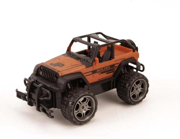
Fuoristrada Telecomandato Jeep, Monster Truck scala 1:18 Buy Cheap Get Authentic
Remote & App Controlled Vehicles
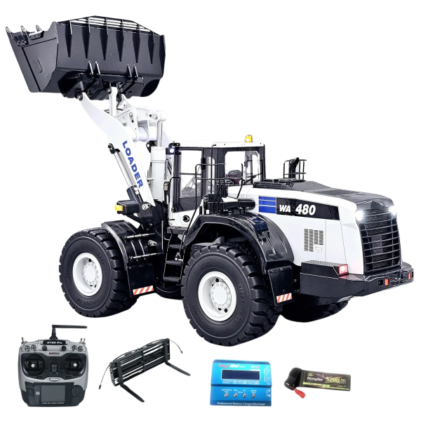
KOMATSU WA480 RC Hydraulic Wheel Loader Free Shipping Original
Remote & App Controlled Vehicles
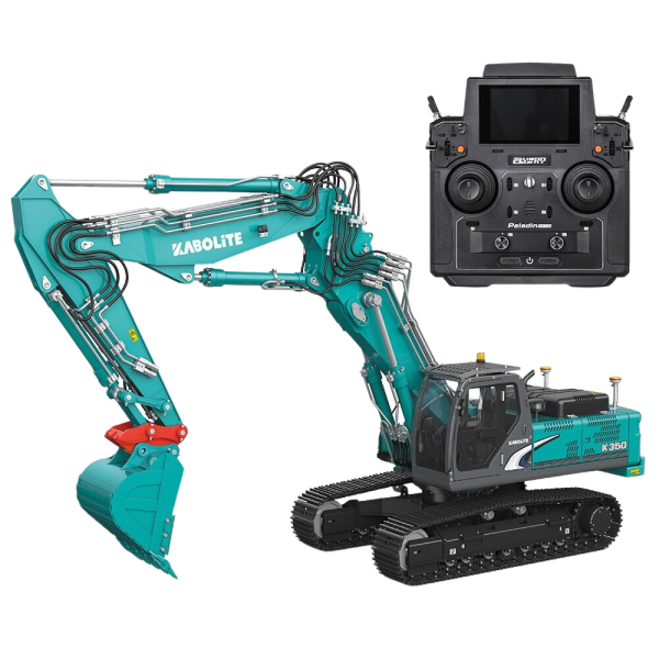
Kabolite K350 200 RC Hydraulic Excavator (2025 Model) Largest Supplier For Sale
Remote & App Controlled Vehicles